About This Course
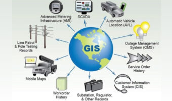
ArcGIS API for Python is a Python library for working with maps and geospatial data, powered by web GIS. It provides simple and efficient tools for sophisticated vector and raster analysis, geocoding, map making, routing and directions, as well as for organizing and managing a GIS with users, groups and information items.
Code: NES_SK_22419
Duration: 80 Hrs / 8 Weeks / Customized
Mode: Online / Offline / Onsite
Curriculum
23 Lessons80h
Module 1
Python Programming Fundamentals
Module 2
Module 3
Module 4
Module 5
Module 6
Module 7
Module 8
Module 9
Module 10
Module 11
Module 12
Module 13
Module 14
Module 15
Module 16
Module 17
Module 18
Module 19
Module 20
Module 21
Module 22
Module 23
Your Instructors
$233.00

PYTHON FOR ROBOT FRAMEWORK
$230.00


PYTHON PROGRAMMING FOR SDN
$230.00
